 ENEA Antarctic Data Center
Meteorological geographical features
Type of resources
Topics
INSPIRE themes
Keywords
Contact for the resource
Provided by
Formats
Representation types
Update frequencies
status
Scale
-
The project aims to determine the mass balance components in the Dome C drainage area and to study and monitor local glaciers in Victoria Land. The goal is to define the mass balance of the ice cap through the analysis of its altimetric variation with satellite systems and through the determination of the values of the positive (snow accumulation) and negative (flow of glaciers to the anchor line) components of the balance mass. Trought the study of the snow cores (collected as part of the ITASE project (XVII/XVIII expedition)), was determined the annual stratigraphy and evaluated the snow accumulation, the isotopic temperature and the chemical composition of the snow cores. Moreover analysis of geophysical data (GPR, GPS, RES, spectroradiometry) and remote sensing data were carried out for the study of the variability of snow accumulation, of the dynamics of the ice cap and of the flow of glaciers to the anchor line.
-
The project aims to estimate the current mass balance of glaciers and in particular of the Antarctic ice sheet by studying the space-time variations of the balance of snow accumulation through the integration of meteo-climatic and glaciological data. Analysis of weather-climatic and snow measurements collected by AWS stations (Dome C, C3, High Priestley, Talos Dome and a Nansen Ice Sheet) using sensors for measuring snow transport and measuring poles. Snow radar data collection of the Dumont d’Urville-Dome C traverse. Analysis of the chemical and isotopic composition of the collected snow samples. Analysis of satellite data to define the path of the Talos Dome-Dome C-Vostok-Dome B-Dome A crosspiece. High resolution chemical / isotopic analyzes (samples in trenches) for the study of post-depositional diffusion / re-emission processes that occur in the part of the snow closest to the surface. Study of the spatial variability of the snow accumulation at the TD site and along the ITASE traverse. Continuation of the analysis of the samples and geophysical data collected in the previous ITASE traverses.
-

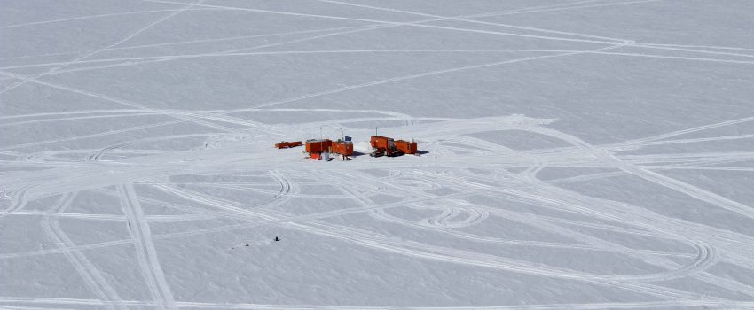
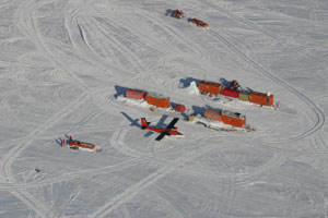
In the MAss LOst in wind fluX (MALOX) project the automatic weather station AWS Virginia purpose is to contribute to the monitoring of global climate change monitoring standard meteorological parameters. The AWS is located at Inexpressible Island (74°56’S 163°41’E) at --- m a.s.l., and has been installed on the ---. It acquired, every minute, all year round, the meteorological vaiables of wind velocity, wind direction, temperature, pressure and relative humidity.
-
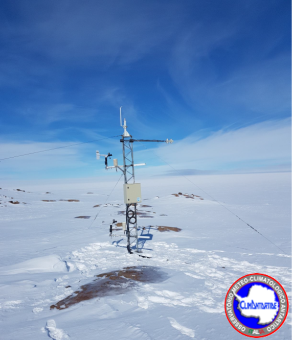
The aim of the MAss LOst in wind fluX (MALOX) project is to better understand the phenomenon of snow transport over a coastal area characterized by strong winds. The automatic weather station AWS Lucia purpose is to contribute to the monitoring of global climate change monitoring standard meteorological parameters. The AWS is located at Larsen Glacier, (74° 57′ 2″ S - 161° 46′ 19″ E) at 1350 m a.s.l., and has been installed the 25 january 2007. It acquires, every minute, all year round, the meteorological variables by two sensors for wind velocity and wind direction, two sensors for temperature (at 1 and 3 meters) and for relative humidity, and finally one for atmospheric pressure. Moreover, the AWS acquires further data using radiation sensor (longwave and shortwave), driftometer for the snow transport and height snow sensor.
-
The project aims to estimate the current mass balance of glaciers and in particular of the Antarctic ice sheet by studying the space-time variations of the balance of snow accumulation through the integration of meteo-climatic and glaciological data. Analysis of weather-climatic and snow measurements collected by AWS stations (Dome C, C3, High Priestley, Talos Dome and a Nansen Ice Sheet) using sensors for measuring snow transport and measuring poles. Snow radar data collection of the Dumont d’Urville-Dome C traverse. Analysis of the chemical and isotopic composition of the collected snow samples. Analysis of satellite data to define the path of the Talos Dome-Dome C-Vostok-Dome B-Dome A crosspiece. High resolution chemical / isotopic analyzes (samples in trenches) for the study of post-depositional diffusion / re-emission processes that occur in the part of the snow closest to the surface. Study of the spatial variability of the snow accumulation at the TD site and along the ITASE traverse. Continuation of the analysis of the samples and geophysical data collected in the previous ITASE traverses.
-
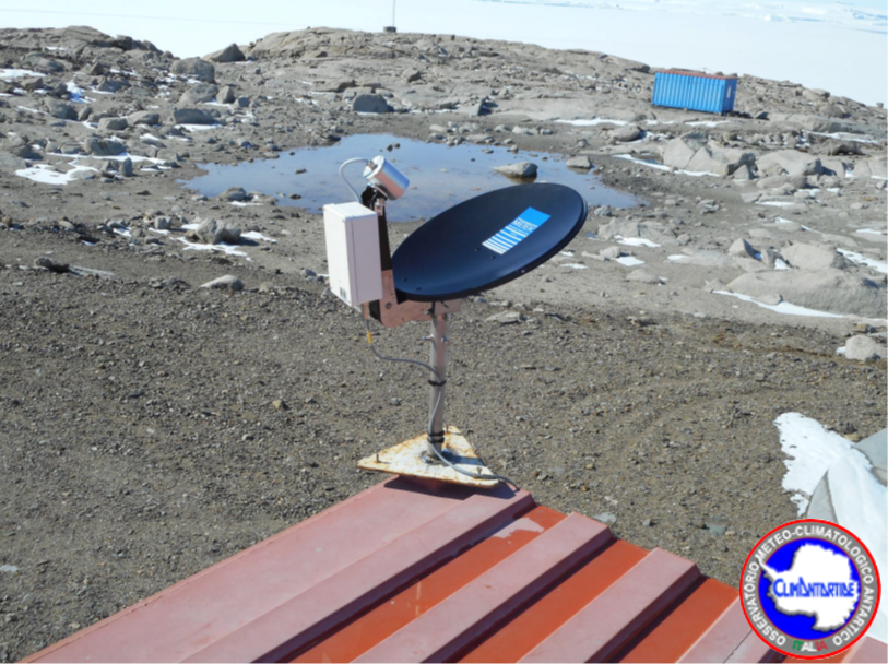
The project is focused on the acquisition of data using the MZS_FRAD2008-02 interference filter radiometer, installed in November 2009 at Mario Zucchelli station, on the roof of the building OASI (74°41.6059' S 164°05.9423' E). The radiometer is active all year round and measures the global solar irradiance (watt / m2nm) at the values of 9 different wavelengths (about one spectrum per minute), where the filters are centered, and obtained from these the measure of the spectral irradiance with a resolution of 0.5 nm. The data is transferred to Italy on a daily basis via an Ethernet link. Data are acquired in the summer station of MZS from November 2009 to May 2013.
-
The project is focused on the acquisition of data using interference filter radiometer DC_FRAD2011-04. Radiometer has been located in February 2012 at Concordia station, on the physics shelter in Dome C (75°06.1620' S, 123°19.1342' E). Is active all year round and measures the global solar irradiance (watt/m2nm) at the values of 13 different wavelengths (about one spectrum per minute), where the filters are centered, and from these it can obtain the spectral irradiance with a resolution of 0.5 nm. The data is transferred to Italy on a daily basis via an Ethernet link. Data are acquired from January 2012 to May 2013.
-

The project aims to carry out a climatological analysis of the dynamics and structure of the Antarctic polar stratospheric vortex over the last decade 1993-2003 and its relationship with the 'Ozone (O3) hole' phenomenon. In particular will be evaluated all the data from the ground by LIDAR, gained by balloon and by satellite, a high resolution transport model and a GCM model will be used for the climatic characterization of the dynamics of the vortex and its interactions with the polar troposphere and mid-latitudes, and finally a climatology of aerosols and PSCs will be analyzed during the polar winter.
-
Data of the precipitation fallen during the summer months (November-December-January) on four expeditions, 2015-16, 2016-17, 2017-18, and 2018-19, in the Terra Nova Bay area, were obtained using a vertically pointing radar, disdrometer and snow gauge. The vertical pointing METEK Micro Rain Radar 2 (MRR) was installed in MZS at the end of November 2015. It records Doppler velocity spectra every 10 s at 32 range gates. The radar gate spacing was set to 100 m allowing the profiler to sound heights ranging from 100 to 3100 m above the surface. The raw K-band power spectra, collected by the MRR, were processed applying the method proposed by Maahn and Kollias (2012) to correct for noise and aliasing effects, making them suitable for snow observation. A Thies CLIMA laser disdrometer (LPM), has been operational since December 2014.The disdrometer can simultaneously count and measure the size and fall velocity of hydrometeors. A Total Rain weighing Sensor (TRwS) manufactured by MPS system was installed during the december 2018 - January 2019 campaign within the YOPP observing period. The TRwS is a total rain/snowfall weighing gauge with an orifice area of 400 cm2, a depth accuracy of 0.01 mm of w.e. and a one -minute sampling time resolution (Savina and others, 2012). The TRwS was protected by an alter shield in order to minimize wind effect over the accumulation inside the instrumentation.
-

Installation of two radiometers with interference filters (F_RAD) operating in the spectral region from 296 nm to 400 nm. The purpose is to measure the global solar irradiance at the values of the wavelengths where the filters are centered and from these derive the spectral irradiance with a resolution of 0.5 nm. The radiometers are currently positioned in the Antarctic stations of Mario Zucchelli and DomeC Concordia and operate permanently throughout the year. Measurements of absorbance of polysulphone dosimeters before and after exposure to UV solar radiation by laboratory spectrophotometer, data analysis, determination of the UV dose response curve vs absorbance variation and comparison of the results detected in the two sites. It can be used for the measurement of solar UV irradiance for research on the climate and the physics of the atmosphere.